

We all have been confused when it comes to picking a region for trekking. So, this article is about what factor differentiate your treks in Indian Himalayan region of Himachal Pradesh, Uttarakhand, Ladakh, Jammu & Kashmir.
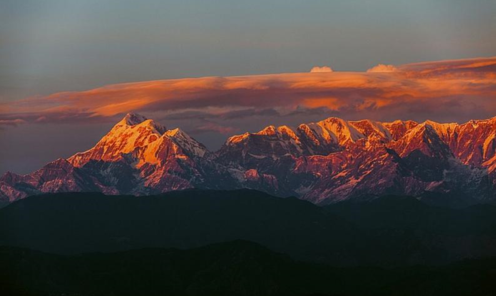
For some, it’s Uttarakhand, according to one of my Client. “What you get in Uttarakhand, you don’t get anywhere in the world,” she says while pointing at the stunning view of Mt Trishul from Kausani. It’s true that such views are visible only from treks in Uttarakhand.
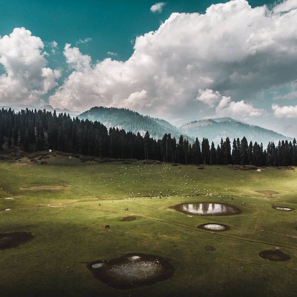
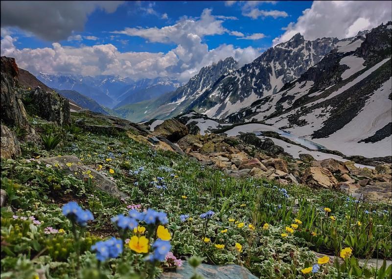
After I visited Kashmir during one of my Road trip, my personal bias leaned towards Kashmir. With willows, poplars, and chinars bordering its vast grasslands, I felt Kashmir had the one of the most charming tree line & grassland. No other state could look so picture-perfect.
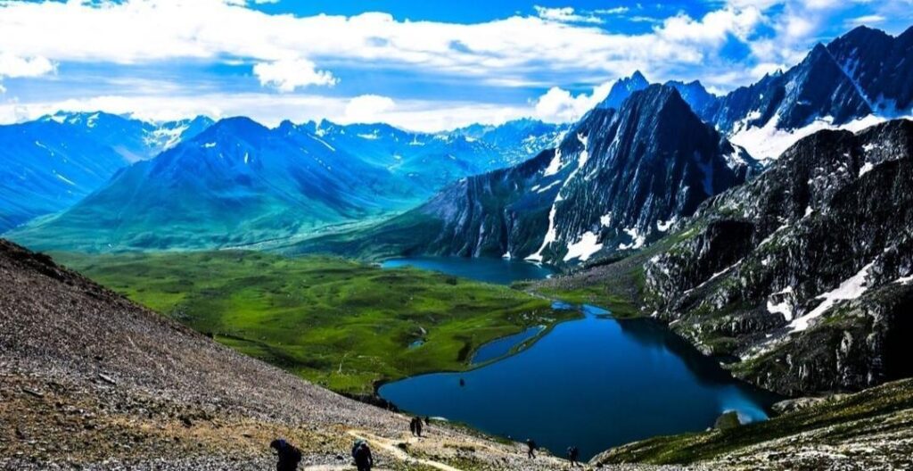
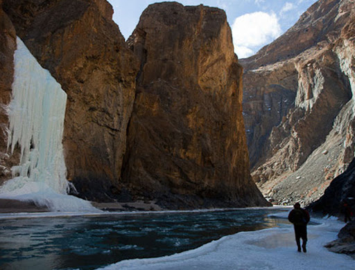
Ladakh, The Land of High Passes, boasts a landscape that can leave you thrilled. A place where the landscape changes dramatically; it is truly astonishing to see the mountains, snow, cold desert, alpine meadows and lakes at a short distance from each other. It has amazing and unmatched treks like the popular Frozen River Trek/Chadar Trek & Stock kangri.
One of my colleague, shares an interesting thought with me. “I am biased towards the treks of Himachal Pradesh,” he says while describing the lush green valleys, and mountains of the state. “You also don’t find such contrasting landscape — like the green Parvati valley and snow desert Spiti — in any other place in India,” he adds.
But Do we even know why these differences exist?
For a long time I thought I knew; but then I realised I didn’t know much.
After a long study of various books at Kunzum Café, Delhi & interacting with fellow traveler I realized,
Latitudes effect on trekking
“The latitude & hemispherical placement of a region determines the angle at which it receives sunlight. That, in turn, affects the flora, fauna, and snow of the region.”
Untill now I hadn’t anticipated the powerful role of latitude as we moved from one region/state to another.
Instantly, scenes from the Kashmir valley flashed across my mind. The landscape in Kashmir looks different from the rest of the country.
This was because of its latitude.
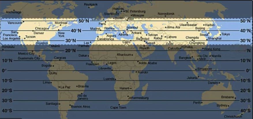
If you observe the latitudes on the world map, you notice that the latitude running through Kashmir is not too far away from that of Southern Europe.
Even though reason seems obvious, but this was a revelation.
Latitude Effect on flora
In Kashmir, the snow covered deciduous forests swiftly give way to alpine meadows. This gives a European similarity to the landscape of Kashmir.
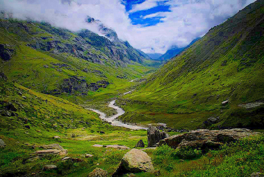
Green silent forests or forests blooming with rhododendrons are found mostly in Uttarakhand. This is the zone for tropical deciduous trees. Unlike the forests in Kashmir, these forests don’t lose their leaves in winter.
Similarly, Himachal Pradesh is well-known for deciduous trees, orchards with apple & low height trees.
And due to Scant precipitation it makes Ladakh a high-altitude desert with extremely scarce vegetation over most of its area.
How Snow on the trek get affected by latitudes
Apart from the flora, the presence of snow also separates one state from another.
Uttarakhand, is closest to the equator among the three states, and has shortest season of snow. It starts from December and soon melts away by mid-April.
But snow takes longer to melt when you move northwards. This is why you find big patches of snow on our Kareri Lake Trek & Bhrigu lake trek even in June.
As you move further up, toward Kashmir, snow starts melting only by July. Throughout the year, when snow has melted in all other states, traces of snow remains in Kashmir.
This is role of latitude in defining ones trek experience.
Secondly Mountain ranges. They play a part too.
Mountain Ranges effect on Trekking
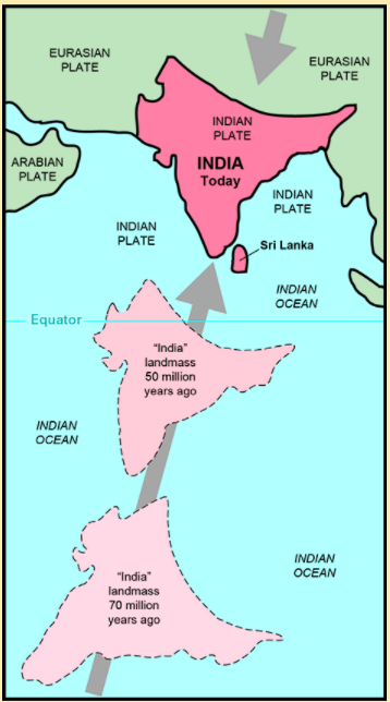
The Himalayas are made up of different ranges. About 80 million years ago, India was located roughly 6,400 km south of the Asian continent, moving northward at a rate of about 9 m a century. When India rammed into Asia about 40 to 50 million years ago, the region of Uttarakhand experienced major changes of the landscape. This formed the Greater Himalayas. This is why mountains are higher and valleys are narrow in Uttarakhand. The landscape became gentler as we moved towards Kashmir & Ladakh, giving way to wider valleys and lower mountains.
In Uttarakhand, you see mountains rising in the Kumaon and Garhwal Himalayas.
In Himachal Pradesh, you have the Kangra valley at the foot of the Dhauladhar range. You also have the Zanskar range and Pir Panjal in Himachal.

The Pir Panjal range divides Kashmir valley from Jammu and further continues towards Pakistan as the Karakoram range with one end touching Mt. Harmukh-‘Kailash of Kashmir’.
Mountain ranges largely influence how you ‘see’ a trek.
How Monsoons are influenced by Mountain Ranges
Almost all Uttarakhand treks are shut down in Monsoon(July to September)- except Valley of flowers. During those months, Uttarakhand receives heavy rains from the southwest monsoons.
The monsoon of South Asia is among several geographically distributed global monsoons.The moisture-laden winds blow from the South to the North. But the Himalayas act as a big barrier to these winds. They do not let the winds pass. As these clouds hit this barrier, they burst and come down as rain on the southern side of the mountain. The other side of the barrier doesn’t receive any rain, so it remains barren and desert-like, creating the rain-shadow regions of our country.
Ladakh receives scanty rainfall because it lies to the north of the Himalayas, in their rain shadow zone. This rain shadow effect is caused by Karakoram ranges on one side, mighty Greater Himalayas and Zanskar ranges on the other side The south-west monsoons cause heavy rains on the southern slopes of the Himalayas. These winds are rendered moistureless by the time they cross the Himalayas and reach Ladakh.
But it is very different in Kashmir & Himachal Pradesh. The effect of the southwest monsoon reduces beyond the Outer Himalayas. Instead, in those regions, the Western disturbances coming from the Mediterranean sea, Caspian Sea and the Black Sea region cause snowfall in winter.
Landscape Changes
Precipitation changes caused by mountain ranges also impacts the landscape of a state.
A beautiful example of this is created by the Zanskar range in Himachal Pradesh. It divides Parvati valley from Spiti and creates a dramatic shift in landscape as you cross the Pin Parvati Pass. During the course of the trek, you leave the lush green of Parvati valley to step into the gorges & cold deserts of Spiti.
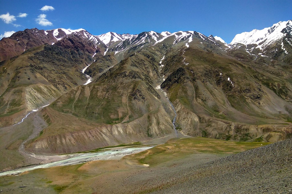
Similarly In Ladakh region, with rare precipitation and scant vegetation except along river beds creates a cold desert. Like the rest of the Tibetan Plateau
Monsoon, influenced by the mountain ranges, determines ‘when’ you trek. But there’s more.
How Proximity to the Mountains Alters your Trekking Experience
No other state has view points better than Upper Uttrakhand from where you can see some of the grandest peaks of India.
But the experience of seeing a peak is different in Himachal Pradesh, Ladakh & Kashmir. Even though the mountains are not as tall as in the Garhwal Himalayas, they can appear grander from Himachal, Ladakh and Kashmir.
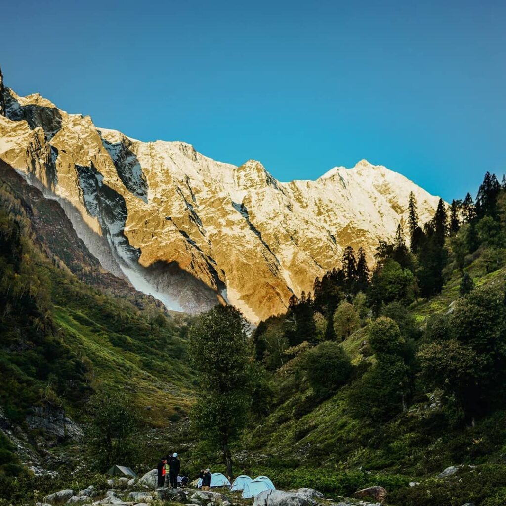
On the Beas Kund Trek you camp right at the foot of the Pir Panjal range. You will see rise of the Friendship Peak and Hanuman Tibba from base to top right in front of you. In Uttarakhand you will miss this kind of experience and thriller.
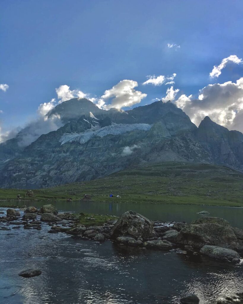
In Kashmir, as you reach, the basecamp of Kashmir Great Lakes trek, the Thajiwas glacier is right in front of you. You even camp near Mt. Harmukh, a mountain towering over Gangabal lake, on your trek.
Interesting Side-note:
Mt Harmukh, with Gangbal Lake at its foot, is considered a sacred mountain by Hindus. It is also known as ‘Kailash of Kashmir’. According to Kashmiri Hindus theology, Harmukh is the abode of Lord Shiva. According to the legend of “Hurmukhuk Gosoni”.
Once a hermit tried to reach the summit of Harmukh to see Lord Shiva face to face. For twelve long years, he tried to scale the summit but failed until one day he saw a Gujar descending the summit. When the Gujar approached him, the hermit enquired as to what he had seen there. The Gujar said he had been searching for a stray goat, and that while searching he saw a couple milking a cow and drinking the milk from a human skull. The couple had offered him some milk, which he refused to drink; when they departed they rubbed a little of the milk on his forehead.
When the Gujar indicated the spot where the milk was rubbed, the hermit was extremely joyful and rushed to lick his forehead. It is said that the hermit attained nirvana and disappeared from the place to the complete surprise of the Gujar.
Best Time for Trekking
Here, I would like to stress upon a point that many trekkers overlook – the choice of a trek doesn’t depend on the altitude or difficulty.
While choosing a trek, search out a little. Observe the topography of region & study about it’s location. Pay attention to the flora and fauna. Find out what sets this trek apart from other treks.
Then, find the best season to do the trek. Know the ‘why’ of the trek before you search for the ‘how’.
Verdict
That brings me to the end of my article on the differences between trekking in Uttarakhand, Himachal Pradesh, Ladakh and Jammu & Kashmir.
But as you can see, the mountain ranges and latitudes have a huge role to play in how the landscapes and terrain affect your trek. They also decide the trekking seasons of each state/region.
So, I would advise trekkers to choose treks based on the season and region, not the altitude or difficulty. It’s not about getting to the highest altitude, it’s about exploring a space that you won’t find anywhere else.
Please drop a comment below changes you have observed while trekking in these regions. We would love to read about them.
Happy trekking! Be safe !
Comments